

Founded in 2017, Carlile Media is one of America's leading independent publishers of high-quality print editions, e-books, and audiobooks.
We specialize in “how-to” titles that help our readers grow their skillsets, achieve their goals, and expand their horizons.
The FAA Flight Navigator Handbook: Full Color, Full Size
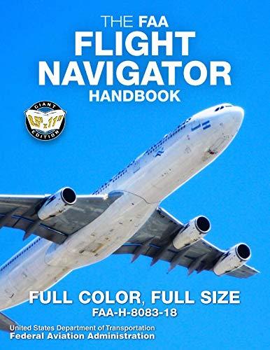
The FAA Flight Navigator Handbook: Full Color, Full Size
Giant 8.5" x 11" Size, Full Color Throughout (FAA-H-8083-18)
Paperback Book
Carlile Aviation Library
Available Now
THE ESSENTIAL GUIDE TO PRACTICAL, SAFE AIR NAVIGATION
- FULL COLOR THROUGHOUT: the theory and practice of air navigation cannot be fully explained or adequately understood with black-and-white illustrations; color is vital. Unlike other versions available, this edition uses full color from start to finish.
- FULL-SIZE 8.5" x 11" edition - large, easy-to-read text and illustrations.
Aviators use air navigation to determine where they are going and how to get there. This handbook serves as a reference for techniques and methods used in these critical skills, covering all aspects of air navigation for navigators and students, including how to measure, chart the earth, and use flight instruments to solve navigation problems.
It also provides information on flight publications, in-flight procedures and low-altitude navigation, and includes reference and supporting material covering mathematical equations, chart and navigational symbols, and celestial computation aids.
MAPS & CHARTS - FLIGHT PLANNING - BASIC INSTRUMENTS - DEAD RECKONING - RADIO AID FIXING - MAP READING - RADAR NAVIGATION - CELESTIAL CONCEPTS - COMPUTING ALTITUDE AND TRUE AZIMUTH - CELESTIAL PRECOMPUTATION - PLOTTING & INTERPRETING THE CELESTIAL LINE OF POSITION - SPECIAL CELESTIAL TECHNIQUES - SEXTANTS & ERRORS OF OBSERVATION - GRID NAVIGATION - PRESSURE PATTERN NAVIGATION - NAVIGATION SYSTEMS - REFERENCES - MATHEMATICAL FORMULAS - CHART & NAVIGATION SYMBOLS - CELESTIAL COMPUTATION SHEET - GLOSSARY - INDEX
Proudly published in the USA by Carlile Aviation Library
ISBN/SKU: 1795471662
Ready to buy?
Reader's Guide
Q: Who is this book for?
A: This handbook is intended for student pilots, navigators, aviation professionals, flight instructors, aviation historians, and readers who want a deeper understanding of practical air navigation. It is particularly useful for anyone interested in the methods used to determine position and course without relying entirely on modern automated navigation systems.
Q: What does the handbook cover?
A: It covers maps and charts, flight planning, basic navigation instruments, dead reckoning, radio-aid fixing, map reading, radar navigation, celestial navigation, grid navigation, pressure-pattern navigation, navigation systems, mathematical formulas, chart symbols, celestial computation, and in-flight procedures.
Q: Is this mainly a book about celestial navigation?
A: No. Celestial navigation is an important part of the handbook, but the scope is much broader. The book progresses through terrestrial, radio, radar, grid, pressure-pattern, and celestial methods, giving readers a comprehensive view of traditional air-navigation techniques.
Q: Is this useful if modern aircraft have GPS?
A: Yes. Modern electronic navigation has transformed aviation, but understanding the underlying principles of position, heading, drift, distance, time, plotting, and navigation remains valuable. The book is especially useful for students, instructors, historians, and anyone who wants to understand how navigation works rather than simply how to operate a particular device.
Q: Is this suitable for student pilots as well as professional navigators?
A: Yes. The material begins with fundamental concepts such as maps, charts, instruments, and dead reckoning before progressing into more specialized techniques. Student pilots can use it to deepen their understanding of navigation, while professional and advanced readers will find considerably more detailed reference material.
Q: What makes this different from a conventional pilot navigation guide?
A: Its scope is unusually broad. Rather than concentrating mainly on the navigation methods used in everyday light-aircraft flying, the handbook treats air navigation as a complete professional discipline, including techniques such as radar, celestial, grid, and pressure-pattern navigation that are rarely covered in comparable depth in ordinary pilot books.
Q: Does the book include practical mathematical and reference material?
A: Yes. In addition to the instructional chapters, the handbook includes mathematical equations, chart and navigation symbols, celestial computation aids, plotting information, a glossary, and other supporting material intended for repeated reference.
Q: Why is full color important in this edition?
A: Navigation depends heavily on interpreting charts, diagrams, plotting information, symbols, and visual relationships. Full-color reproduction makes many of these illustrations easier to distinguish and understand than black-and-white versions, particularly when several kinds of information appear together.
Q: Why choose the full-size edition?
A: This edition uses the original 8.5 × 11-inch format and runs to approximately 280 pages. The large page size is especially valuable for charts, diagrams, equations, celestial-navigation material, and plotting examples, making the book much more practical for study and reference than a compressed reproduction.
Explore Related Articles

How to Build a Decision-Based Flight Lesson
A good flight lesson does more than produce a technically correct maneuver. Use a simple...

Before You Press NAV: A Simple Briefing for Flying With Automation
A glass cockpit can reduce workload, but only if you know what it is doing now, what it...

Why Your GPS Track Is Not Your Planned Course
A moving-map display is a superb navigation aid, but it does not replace understanding...
Publication Details & Specifications
| Format | Paperback |
|---|---|
| Series | Carlile Aviation Library |
| Official designation | FAA-H-8083-18 |
| Edition | Full-color, full-size edition |
| Print length | 280 pages |
| Dimensions | 8.5 × 0.66 × 11 inches |
| Item weight | 1.78 pounds |
| Language | English |
| Publication date | April 14, 2019 |
| ISBN-10 | 1795471662 |
| ISBN-13 | 978-1795471664 |
| Source | Federal Aviation Administration |
| Color | Full color throughout |
| Focus | Practical air navigation for navigators, pilots, students, and aviation professionals |
| Navigation coverage | Maps and charts, flight planning, basic instruments, dead reckoning, radio-aid fixing, map reading, radar navigation, and navigation systems |
| Celestial navigation | Celestial concepts, altitude and true-azimuth computation, precomputation, plotting and interpreting celestial lines of position, special celestial techniques, sextants, and errors of observation |
| Advanced navigation | Grid navigation, pressure-pattern navigation, in-flight procedures, and low-altitude navigation |
| Reference material | Includes mathematical formulas, chart and navigation symbols, celestial computation aids, glossary, references, and index |
| Format advantage | Large 8.5 × 11 inch format with full-color charts, diagrams, and illustrations for subjects where color materially improves understanding |
Affiliate notice: as an Amazon Associate, we earn from qualifying purchases.