A route can look wonderfully short on a map and still be a punishing choice on the ground. The difference is usually hiding in plain sight: contour lines. Read them well and you can spot the steep climb, the enclosed draw, the broad ridge, and the sensible crossing point before your boots leave the trailhead.
A contour line joins points at the same elevation. Together, the lines show the land’s three-dimensional shape on a two-dimensional sheet. They are not decoration. They are the map’s most useful warning about effort, visibility, drainage, and route options.
Start with the contour interval
Before interpreting any hill or valley, find the contour interval in the map margin. This is the vertical elevation difference between adjacent contour lines. On one map it may be 20 feet; on another it may be 100 feet.
That number gives the lines meaning. Crossing five contour intervals on a 20-foot map means gaining or losing about 100 feet of elevation. Crossing five intervals on a 100-foot map means about 500 feet. Count intervals, not merely lines, and remember that every map may use a different interval.
Use spacing to judge steepness
Close contour lines mean the elevation changes quickly over a short horizontal distance: steep ground. Widely spaced lines mean a gentler slope. A nearly contour-free area may be fairly level, though small features can be omitted at a given map scale.
Spacing matters more than the printed elevation alone. A 300-foot climb spread over two miles may be manageable; the same gain packed into a few hundred yards deserves a second look. When planning, trace your intended route and notice where it crosses the tightest bands of contours. Those are likely to be the slow, tiring parts.
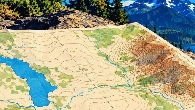
Recognize the four shapes that affect a route
Hilltops
Closed contours with elevations increasing toward the center usually indicate a hill or summit. If the center has hachure marks—short ticks pointing inward—it indicates a depression instead: ground that falls toward the middle.
Ridges
A ridge is a long area of higher ground extending away from a hill or mountain. Its contours form rounded U- or V-shaped bends that point downhill, toward lower elevation. Ridges can offer drier footing and broader views, but they may also be exposed to wind and weather.
Draws and valleys
A draw is a small valley; a larger valley may contain a stream. Where contours cross a drainage, their V shape points uphill, toward higher elevation and the source of the watercourse. This is a dependable way to distinguish a valley from a ridge when the map initially looks like a tangle of brown lines.
Saddles
A saddle is the lower ground between two higher points, often resembling an hourglass in the contours. It can be a useful passage between drainages or over a ridge system, but it is not automatically easy terrain. Check the approach on both sides; one side may be gentle while the other is sharply steep.

Make a route decision in five passes
- Mark your start, objective, and handrails. Handrails are linear features that help keep you oriented, such as a trail, creek, road, ridgeline, or powerline. Use them to divide a long movement into manageable sections.
- Read the contour interval and identify the highest and lowest ground. This tells you the scale of the climb or descent you are considering.
- Trace the route across the contours. Look for sections where it repeatedly crosses tightly packed lines. Compare those sections with a longer option that follows gentler spacing.
- Identify landforms you can confirm on the ground. A ridge, bend in a valley, saddle, stream junction, or prominent hill can serve as an attack point or checkpoint. Avoid relying on a vague feature such as “some woods” when a distinct terrain feature is available.
- Check the route against conditions. A map does not tell you everything. Consider daylight, weather, water crossings, vegetation, restrictions, the ability of your group, and whether a contour-based shortcut puts you into ground you cannot safely or legally cross.
Do not confuse the shortest line with the best route
Good land navigation is not a contest to cross the fewest inches of paper. A slightly longer route that follows a contour, uses a clear handrail, avoids a severe climb, and provides reliable checkpoints may be faster and safer than a direct line across broken ground.
Conversely, contouring around a slope—traveling at roughly the same elevation—can save vertical effort but may be awkward on steep side slopes, where footing is uneven and constant balance work becomes exhausting. Route choice is a trade-off. Read the shape of the ground first, then choose deliberately.
Practice from a chair before practicing outside
Take a familiar local topographic map and predict what the terrain will look like along a road, trail, or route you already know. Find the stream valleys, steep road cuts, gradual approaches, and high points. Then compare the map with the ground. Repeating that simple exercise builds terrain association: the ability to connect map patterns with what you see around you.
For a fuller treatment of grids, scale, direction, terrain association, compass work, and navigation in varied environments, The Official US Army Map Reading and Land Navigation Handbook is a substantial large-format reference. Its value is not merely in memorizing symbols; it helps turn the map into an informed plan before movement begins.